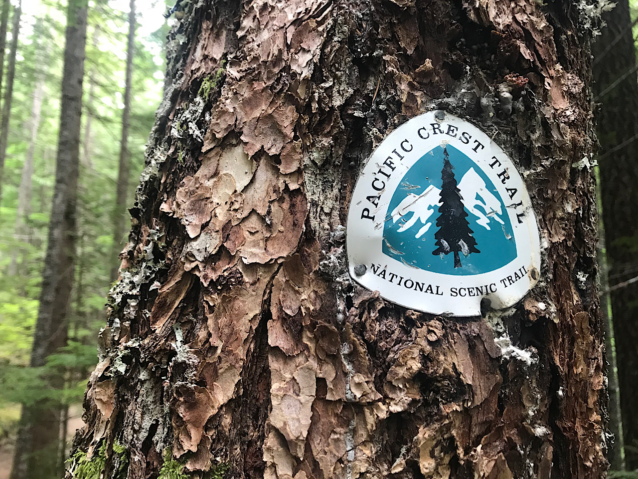
The SOBO Guide
- Introduction
- FAQ
- The Video
- Why SOBO?
- Urgency and its effects on Trail Culture
- Climate Change and Forest Fires
- Choosing a Start Date
- The Snow Deadline
- Avoiding the Fearmongering
- Bubble Pace
- Tracking Miles
- Gear Philosophy
- Preparation
- The first 3 weeks
- Transport to Harts Pass
- Resupply
- What to Expect
- Shrink’s General Tips
Introduction
What is this guide?
There are many great resources to help you plan your PCT thru-hike. I wrote this guide because there aren’t many that focus on those going Southbound. The trail is the same, but the direction of travel makes a big difference on your experience!
I hope this guide will help fill the gaps.
What this guide isn’t!
This guide is not the final word on all things SOBO! The thru-hiking experience is extremely subjective. Everyone will have a different experience. I’ve tried to keep the advice generic and appropriate to as many people as possible. As always - Hike Your Own Hike!
About Shrink
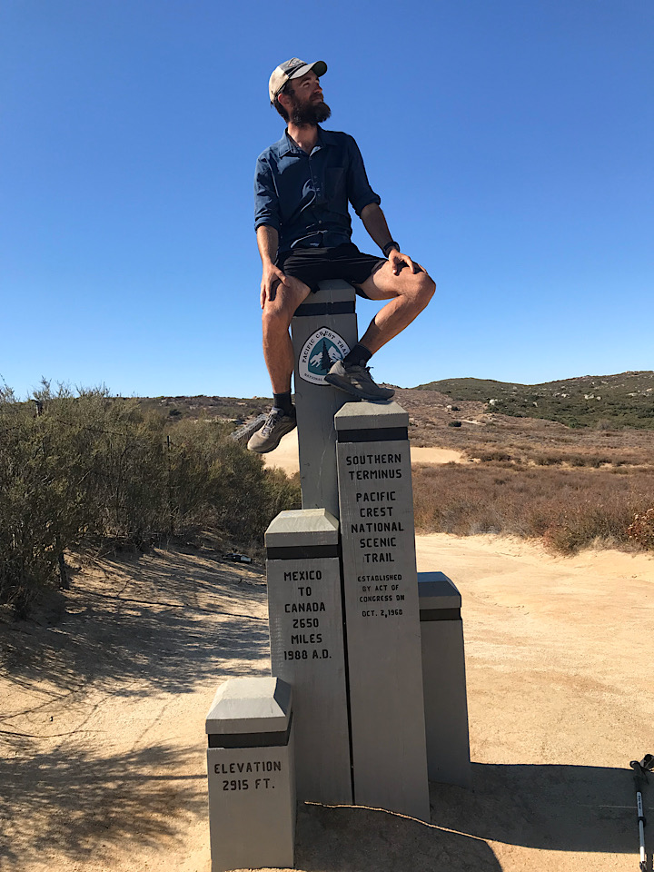
I’m a British-born hiker living in the US. I completed a full SOBO thru-hike, all 2,653 miles, in 2019
I tagged the Northern Terminus on June 29 and reached the Southern Terminus in Campo on November 4th, a total of 129 days.
2019 was a great year for SOBO travellers:
- Minimal snow in Washington
- Good weather in the Sierras
- Few if any fire closures
Thru-hiking has enriched my life in so many ways. It was been the journey of a lifetime.
Contact Shrink
You can find me on Reddit with the username butterguns. Drop me a DM.
Changes
| v1.4 | 1/24/2022 | Formatting, Climate Change section, closures, FAQ |
| v1.3 | 2/4/2020 | Sonora Pass Resupply company is closed |
| v1.2 | 1/10/2020 | Remove Amazon section |
| v1.1 | 12/30/2019 | Resort closures, Fearmongering, Bubble Pace |
| v1.0 | 12/9/2019 | Initial Release |
FAQ
Here are some questions that commonly get asked on the PCT subreddit, and some quick-fire answers. Each is elaborated on further in this guide
Q: Why should I consider hiking SOBO?
A: Smaller crowds, arguably better weather, and a subtly different trail culture to what NOBOs experience.
Q: Is it harder than going NOBO?
A: Yes. Your shorter hiking window will mean less time on trail, and more miles per day. You’re starting in Washington, a tough state.
Q: Will I be lonely?
A: No. Plenty of people hike SOBO. There is a better balance of socialising and alone time.
Q: Do I really need to do an out-and-back (extra 30 miles) to get to the Northern Terminus?
A: Yes, if you want to get to the northern terminus, there is an extra 30 miles of hiking in the wrong direction. The good news is - it’s incredibly beautiful.
Q: Will I get trail magic going SOBO?
A: Yes, but not as much as going NOBO.
Q: How should I train for the trail?
A: Focus on injury-management. Then start gentle cardio (walking, hiking, running), ideally with weight on your back.
The Video
I shot small sequences on my iPhone, along different parts of the trail. Here is my full journey:
Why SOBO?
The SOBO hiking experience has many advantages over going NOBO:
- Less busy
- Experience one of the best States (Washington) immediately
- Better temperatures in Southern California
NOBO Crowds
In recent years the PCTA has released 50 permits per day throughout the the Northbound season. In 2018, 4,500 Northbound thru-hike permits were issued. That is in contrast to 491 Southbound permits for the same year.
The PCT going NOBO is crowded. The popularity of the trail has skyrocketed in the last decade, to the point where it is now very difficult to secure a permit. The crowded nature of the trail ran counter to what I was looking to experience: solitude, independence, peace, and a feeling of being alone in the woods. This was the defining issue for me. I didn’t want to be squeezing 15 people into a 4-person tent site. I didn’t want to be hurrying into town early to get the few remaining hotel rooms. Trail Families weren’t important to me.
This is a personal preference, it’s not a value judgement. Everyone should examine their own reasons and motivations for hiking.
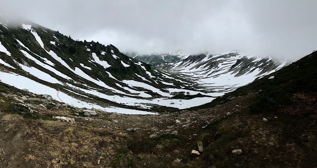
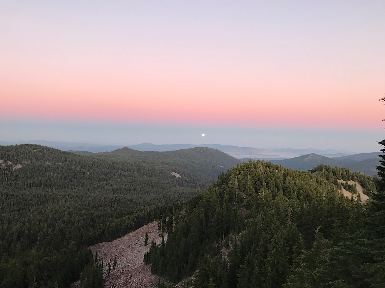
Washington
Sadly, many people are forced to end their thru-hike within the first month. If that is the case for you, at least you will have experienced hiking through Washington, one of the most incredible portions of the trail. And the beauty begins right away - the first 30 miles from Harts Pass to the Northern Terminus consistently ranks as one of the most spectacular trail sections.
A cool Desert
Going NOBO through the Southern California in April / May is a gruelling experience. You have to be prepared for 100+ degree days and often little shade.
SOBOs will hike through the desert in October and November, when daytime temperatures will stay in the 70s and 80s, with lows in the 30s and 40s at night.
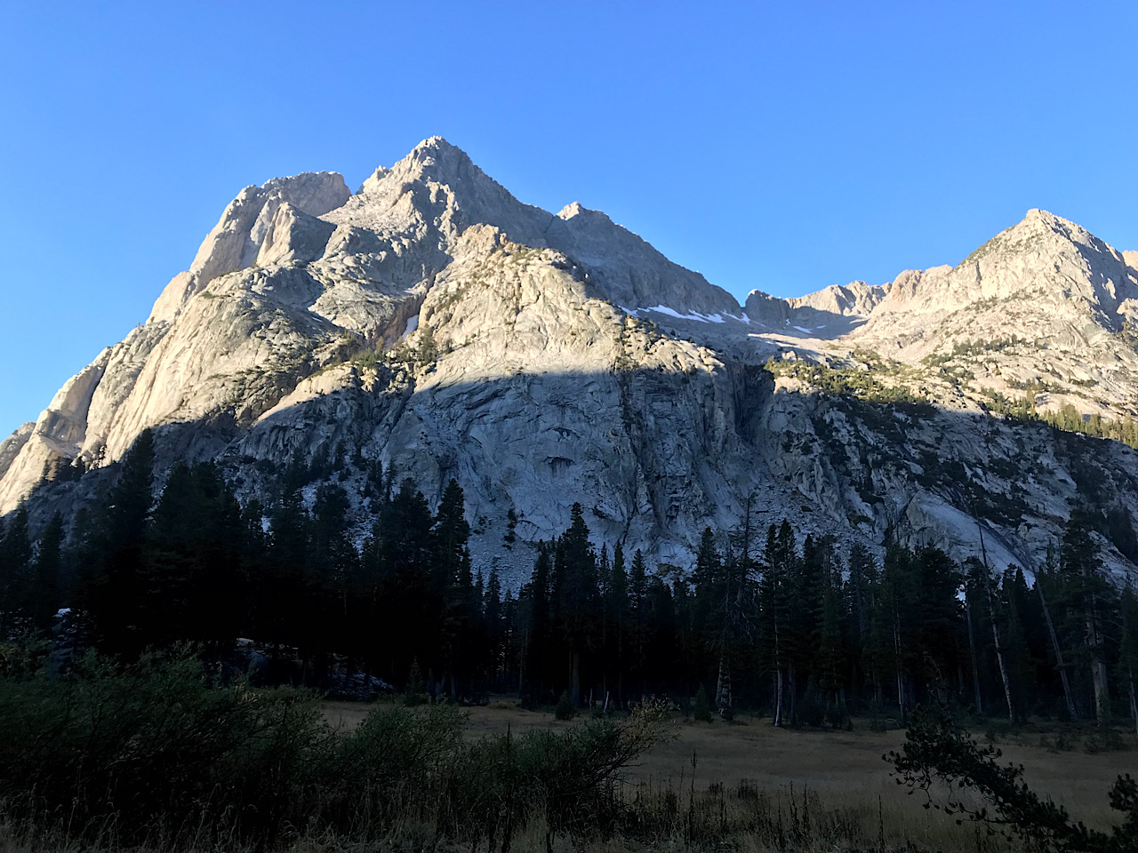
Snow-free Sierras
Once you reach the Sierra Nevada in September, almost all of the settled snow will have melted. There won’t be any bugs. Passes should be easy. You’ll be in great physical shape and ready to knock out 25+ mile days.
Urgency and its effects on Trail Culture
Urgency is a huge component of a SOBO thru-hike. You should be through the Sierras before the snow sets in for the winter.
You should aim to exit the Sierras by October 15th. If you start your thru-hike on July 1, you will have approximately 100 days to go 1,800 miles to Forester Pass, after which they descend out of the Sierras into the desert.
This goal is in the forefront of a SOBO hiker’s mind. I rarely met anyone who didn’t have at least some background anxiety about making it in time.
The flavour of a SOBO hike is therefore characterised by:
- Few zeroes
- Big mile days
- Pressure to hit your stride early (be very wary of this!)
- Brief town stops
I believe this produces a trail culture that is quite different to the NOBO experience. There is very little “party culture”. Sometimes you will find yourself rushing through experiences that you wished you had longer to take in and enjoy. Self discipline is important. You might feel guilty when you’re not walking (a feeling that stayed with me even after I finished the trail)!
There are also real benefits that come from being part of the SOBO community. Most people are there because of a specific reason to go South, not just by default. Anecdotally I would say the level of experience and preparation is higher. I had a really great time meeting people that had a focus and drive that matched my own.
I didn’t really see any large Trail Families. Most people I met were looking for some degree of solitude, which would allow them better to connect with the surrounding nature. Several times I ran into oncoming NOBOs who travelled in groups of 8 to 12, something that would look out of place for SOBOers. Many SOBO hikers I spoke to really valued their independence and didn’t want to compromise their drive to reach the Southern Terminus. If their group was walking too slow, it was time to push on ahead alone. You’ll always meet more hikers ahead of you.
Climate Change and Forest Fires
I’m writing this section in winter of 2022, after witnessing multiple disasterous years of wildfires along the PCT. The trail has changed significantly from when I hiked in 2019. In 2021, the Forest Service closed multiple wilderness areas within California, rendering much of the trail off-limits for hiking during the peak PCT SOBO season.
Wildfires will continue to be a major issue for states on the West coast, and for PCT hikers. SOBO hikers will be impacted more than their Northbound counterparts due to their later entrance into California.
It’s sad to say that wildfire risk makes the calculation to go SOBO even more difficult in recent years. My advice to hikers:
- Always be flexible with your plans, and never put yourself at risk when it comes to fire.
- Keep track of fires using the Inciweb website.
Choosing a Start Date
This has been elaborated in far more detail at PCT Southbound. Go check it out. But briefly:
- If it’s your first time on trail, and you have little experience with alpine hiking in the snow, aim to start 7 days after the snow depth at Harts Pass hits zero. You can find current snow levels for Harts Pass here
- If you’re experienced with walking through snow, you may be able to start earlier. Just remember that the road up to Harts Pass may not be completely passable, requiring some extra miles of walking.
- Anywhere between July 1 and July 7 is a good bet
2020 Permitting Changes
For the 2020 season, the PCTA has restricted the number of daily permits for SOBO to 15. I believe they also want to make sure that people start on their permit date.
When applying for your SOBO permit, you will have no idea what the snow conditions are going to be like for that season. It will be impossible to precisely predict when to start.
I have some personal feelings about the strict rules regarding start dates for SOBO hikers. I don’t believe people should be risking their lives to start on their permit date if the snow conditions are worse than they are comfortable with.
The Snow Deadline
The Sierra snow deadline is the key date to keep in your mind: approximately October 15.
It’s impossible to know exactly when the snow is going to arrive each year. There will be early snows that may last a day or two, but don’t signal the end of the season.
You don’t have to get all the way to South Kennedy Meadows by the time the snow settles in. You will want to have completed Forester Pass by that time. This gives you a few extra days to play with.
Work your way back from that date. Give yourself 2.5 weeks to get from South Lake Tahoe to Forester Pass.
That means finishing NorCal by around September 25th
Avoiding the Fearmongering
Keep the snow deadline firmly in the front of your mind. Keep on top of the weather reports as you approach the high passes. Seek advice from others on the trail, particularly those coming North. Watch the InciWeb website for wildfires.
Conversely, watch out for fearmongering! Every hiker is managing their own fears and doubt about making it all the way to Campo.
I was personally told about difficult snow crossings that never materialised, and wildfires that never existed.
- When someone gives you a report of adverse trail conditions, ask them: “did you personally see / experience this? Or are you reporting the information second hand from someone else?”.
- Try and get different multiple independent sources for information.
- The best sources of information are Ranger Stations in the area. If you are concerned, call them and ask for a report of conditions on the ground.
Bubble Pace
People on trail talk about the “Bubble”: a large grouping of hikers, all within maybe 1 week of each other, who are setting the average pace. Those in front and behind the bubble, particularly going SOBO, might see fewer people and spend more time hiking and camping alone.
In 2019 I hiked mainly inside the Bubble. I’d sometimes see 10+ people at major town stops.
Here was my 2019 pace:
| Mile | Stop | Date |
|---|---|---|
| 0 | Northern Terminus | 6/29 |
| 366 | White Pass | 7/22 |
| 505 | Cascade Locks (End of WA) | 7/28 |
| 755 | Shelter Cove | 8/10 |
| 935 | Ashland (End of OR) | 8/18 |
| 1344 | Chester (Halfway) | 9/05 |
| 1563 | S. Lake Tahoe (End of NorCal) | 9/13 |
| 1744 | Reds Meadow | 9/23 |
| 1892 | Witney | 10/01 |
| 1959 | S. Kennedy Meadows (End of Sierra) | 10/04 |
| 2387 | Big Bear Lake | 10/23 |
| 2653 | Campo (End of PCT) | 11/04 |
Tracking Miles
I created a Google Spreadsheet for tracking miles. It calculates:
- How many miles you’ve done each day
- Average Miles / Day
- Average Miles / Day (10 day rolling average)
- Estimated finish date, based on Average Miles / Day
- Estimated finish date, based on Average Miles / Day (10 day rolling average)
Make a copy of the sheet to your account and start filling it in from the Northern Terminus
Gear Philosophy
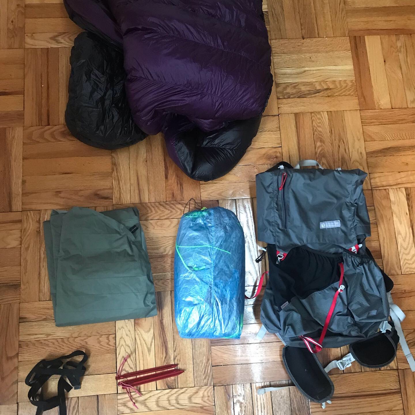
The trail can be thought of in one of two ways:
- One continuous hike
- Five separate hikes
One continuous hike
You choose one set of equipment to carry from Canada to Mexico, through all environments, temperatures, and weather conditions. This is a simple approach - you won’t need to worry about swapping out gear, or bouncing it from town to town. You’ll be better equipped for more extreme weather. One friend I hiked with on the trail described it as more “pure” experience.
The obvious downside is that for much of the trail you’ll be carrying things that are overkill for your environment. Having a heavy, warm, 10 degree F sleeping bag is largely unnecessary for the majority of Oregon and Northern California. A double wall shelter in the Desert is overkill when it barely rains and there are no mosquitos. On my thru-hike in 2019, I didn’t set up my shelter once after Mount Whitney. That’s 750 miles carrying an item that could be switched out for something much lighter such as a tarp.
Five separate hikes
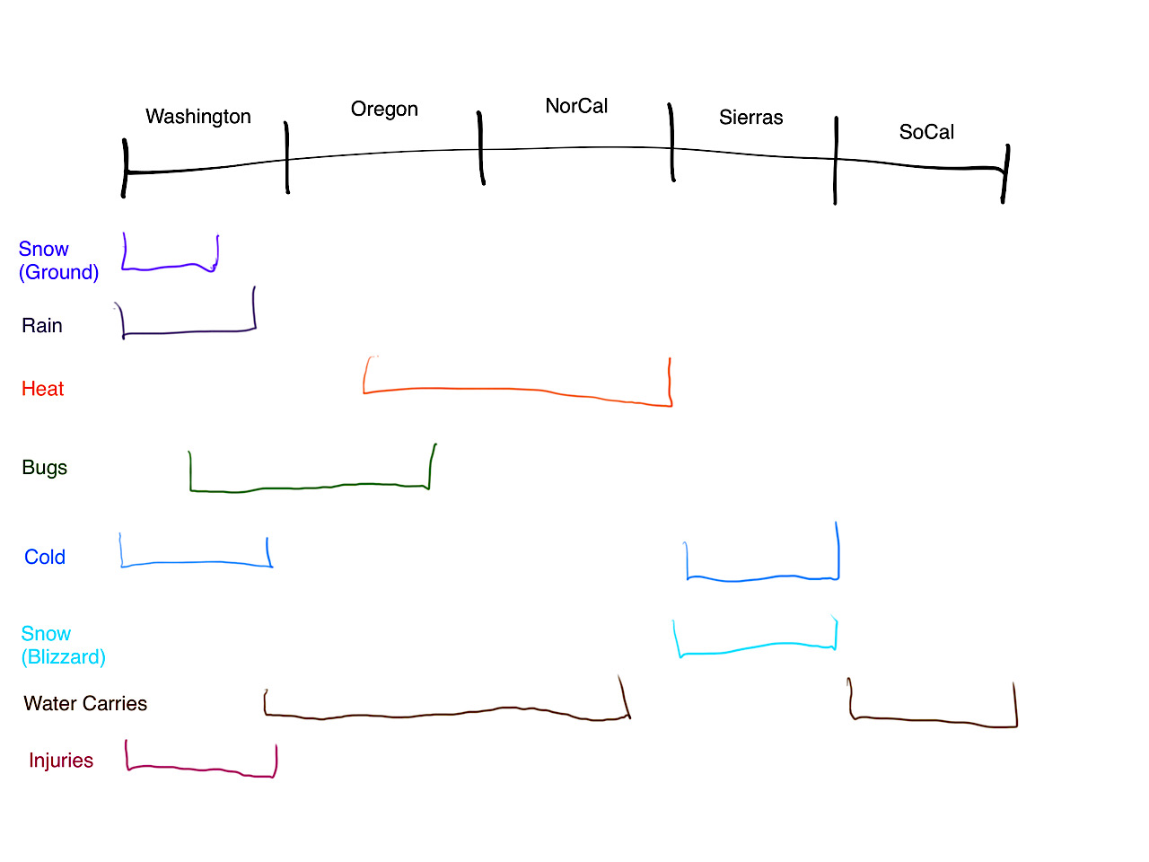
If you have the luxury of owning multiple pieces of gear that are suited to different seasons, my personal recommendation is to treat the trip as 5 separate hikes. Each portion (Washington, Oregon, NorCal, Sierra, SoCal) brings different weather conditions, bug intensity and temperature variations.
Here is a breakdown of each section and some ideas of what gear might be swapped in or out:
| Section | Conditions | Thoughts |
|---|---|---|
| Washington | Wet, cold, buggy | This is where you need most of your gear. Perhaps consider synthetic clothing over down, which will trap warmth better when wet |
| Oregon | Dry, warm, buggy | Fewer layers, lighter sleeping bag and pad, lighter rain gear |
| NorCal | Dry, hot | Even fewer layers and lighter bag and pad, long pants not necessary to repel bugs. Minimal sleeping clothes. This was my lightest pack weight |
| Sierra | Snow, very cold, no bugs | No more bugs. Be ready for snow. Heavy bag and pad. Warm sleep layers! |
| SoCal | Dry, somewhat cold, no bugs | Minimal shelter. Some warm layers |
This strategy requires thought, planning, additional expense (equipment costs and mailing fees), a small amount of additional risk of things not being there when you need, and a higher tolerance for weather variations.
The upside is a much lower pack weight! If you’re planning on going ultralight, this strategy should be seriously considered. I think a common theme amongst hikers I met on the trail was thinking about what they were carrying and what they didn’t need. It’s a very gratifying feeling to know you are carrying only what you need, knowing what you can do without. It becomes a mindset, one that I’ve found useful back in regular life.
None of this strictly requires pre-planning. You can decide to swap out or mail gear onwards while you are actually out there. This might be beneficial - you’ll get an idea of exactly what you need in your current section through experience, not guesswork.
I would certainly recommend keeping a box of gear with the person who mails your boxes. This will be your alternative equipment you might need on the trail.
Preparation
Fitness
The advice over at PCT Southbound is that fitness preparation should be your number one concern leading up to your hike. I mostly agree with this. The better shape you are in when starting at Harts Pass, the better experience you will have in the first month of your hike.
However, training for long distance hiking isn’t particularly easy. There’s no substitute for actual hiking, which takes a lot of time. I found myself getting anxious about not having done enough training as my start date approached. Making time to train wasn’t easy when I had to move out of my apartment, put all my things in storage, hand over work at my job, and prepare my Washington resupply! I always felt behind in my preparation.
I was sacrificing my mental wellbeing by putting extra pressure on myself.
Take an honest look at your physical condition. Do you live an active life? Do you run / hike / lift / climb / play team sports? If you do, then I feel like you can make up any fitness gap on the trail itself, even in the tough Washington environment. Any extra preparation you do is a bonus.
If you live an inactive life or find cardiovascular exercise difficult, then I think fitness preparation is incredibly important and should be your number one priority pre-trail. You’re going to be thrown into the deep end on a SOBO hike.
Injury Management
If you have any pre-existing injuries that you suspect may reoccur on the trail, this should be your primary concern. Injuries, particularly stress-related such as shin splints, plantar fasciitis, or anything achilles related, are hugely prevalent on the trail and commonly end people’s adventures barely after they started.
The trail is going to beat your body into a pulp in the first month. It’s going to break down before it has time to adapt.
Do whatever you can do ahead of time: specific exercises, stretching, PT, conditioning or whatever it is that works for you.
Keeping Perspective
My biggest day on trail was 40 miles. If you told me before hand that I would do a 40 mile day, I would have laughed at you. During preparation, I was stressed out at the idea of even doing 25’s each day, a goal I knew I would need to hit in order to make it to the end.
Please don’t stress! Your body will adapt. You will achieve things you never imagined possible. Your benchmarks of what you consider a “big day” will change. You’ll tap into a source of strength that perhaps you’ve never used before. This is one of the greatest rewards of the trail and it’s waiting for you!
Mental Preparation
Mental preparation is hugely underrated, and something I hadn’t considered much until I read the wonderful book Pacific Crest Trials.
I think everyone approaches the hike with a different level of confidence. You might begin your trip feeling like you’re about to finally fulfil your destiny. That all your life decisions have led you to this wonderful adventure and it’s happening right now! This is your moment, your success is ordained and undeniable.
On the other hand, you might be racked with nervousness and anxiety. Full of doubt. Can I make it? What the f**k was I thinking, this is insane! I can’t do this. I haven’t prepared enough. I’m foregoing comfort, friends, an easy life, certainty, routine, all to be out here.
Likely you are somewhere between these two poles. It is my strong opinion that the closer you are to the former, the better your experience is going to be and the more chance you have at success.
Dealing with anxiety is far from an easy thing. Each person needs to approach it differently. Is there something you can do to take the weight off your mind and aid your mental preparation for the trail?
Thousands of people have come before you, successfully completed their hike, and want to channel this advice to you: it’s going to be great! You’re going to be fine. It’s going to work out, even if you might not see it yet.
The first 3 weeks
NOBOs have a big advantage at the start of their hike. They have no big deadline to hit yet and they start in some moderate terrain / elevation.
SOBOs don’t have that luxury!
SOBOs feel the pressure, and that can make us make poor decisions! I can’t stress this enough…
Start slow!
You may want to hit an overall walking average of 25 miles a day, but please don’t start at that pace! The first 3 weeks is when so many people suffer stress injuries from their body not being used to repeated hard days. And the days are hard in Washington.
I got Shin Splints. So did many of my fellow hikers. A good friend was knocked off trail permanently due to Achilles issues that came on within the first 300 miles. Plantar Fasciitis is common.
For me, I felt fit enough to do 25s each day right out of the gate, but my body was not ready for it.
This trip is long. You have a lot of time to make up the miles in Oregon and NorCal. Hitting 30s and even 40s in those states were not uncommon for me - my body had hardened into an unbeatable walking machine.
Don’t get hurt while you’re still soft clay.
Go easy on yourself
The first few weeks are going to be incredibly visceral. A relentless tide of new people to meet, skills to learn, and limits to find. You might start doubting yourself, feeling homesick, wondering what the f**k you’re doing out here.
Take it easy. Spend an extra day in town if you need it. Vocalise your thoughts; there’s a good chance others are feeling the same way. You’re not out there alone - there’s a community of people there to support you.
The transition from regular life to trail life can be jarring at first. If you’re feeling out of your depth, give yourself at least 3 weeks before making the decision to leave the trail. Your brain might be screaming at you to trade in those trail runners for your old, comfortable life. Stick it out as long as you can! There’s no shame in quitting, but make sure you’ve given it a real chance first.
Transport to Harts Pass
Most SOBO thru-hikes begin at Harts Pass trailhead. It is also possible to start at Holman Pass, but far fewer people choose that option.
The two clear options to get to Harts Pass are as follows:
- From Wenatchee, take public transport to..
- Winthrop, then hitch to the trailhead
- Twisp, then hire the Classic Mountain Cabbie (private taxi) to drive to the trailhead
- From Seattle, have someone drive you (or hitch) to Harts Pass
I would recommend checking out the PCTA page for Getting to the Northern Terminus.
I would personally recommend getting to Wenatchee and taking public transport to Winthrop. It is easy and convenient, and you’re likely to meet a bunch of SOBOs on the bus! The hitch to Harts Pass is pretty easy if the snow has completely melted at the trailhead.
Your steps are:
- Wenatchee to Pateros. You can buy a ticket at the counter or online. If you purchase online make sure you PRINT your ticket (not mobile phone)!
- Pateros to Twisp (purchase on the bus)
- Twisp to Winthrop (purchase on the bus)
To get to Wenatchee from Seattle, either:
- Fly (Alaska Airways). For me, the cost wasn’t that much more to go to Wenatchee than to Seattle.
- Take the bus (Wenatchee Valley Shuttle)
If you’re like me, you might find the idea of trying to hitch to Harts Pass a bit daunting. I had no hitching experience at that point. Overwhelmingly the feedback I got was that getting a hitch was easy and fast.
Resupply
Resupply Spreadsheets
I’m not going to duplicate what is already out there. There are some wonderful resupply guides for SOBO in spreadsheet form. Make a copy of them into your account. Choose one that works well for you.
The Sierra Resupply Guide
As I approached the end of NorCal, I found myself unprepared for how to get through the Sierra. I hadn’t really given much thought about resupply because up until then it was pretty easy - I could do much of it on trail, there were plenty of trail towns to choose from, and no passes to exit from.
The Sierra is a section worth taking time to plan for ahead of time! Even if you don’t want to commit on one strategy right away, know your options.
Overview
2022 update: Tuolumne Meadows campground is closed starting 2022. Store and postal services will still be available in some capacity. Read more here and consider skipping Tuolumne entirely, opting instead to push through directly to Red’s Meadow / Mammoth Lakes.
Here are the prominent resupply points through the Sierra:
| Mile | On-Trail | Off-Trail | Comment |
|---|---|---|---|
| 1636 | - | N. Kennedy Meadows | Good store + Mail. Tricky hitch |
| 1710 | Tuolumne Meadows | - | Poor store selection |
| 1746 | Red’s Meadow | Mammoth Lakes | Easy hitch out to Mammoth. Poor store selection at Red’s |
| 1774 | - | Vermillion Valley Resort | A quick boat ride or side trail. See “The Resorts” section |
| 1795 | Muir Trail Ranch | - | Pretty much on trail. See “The Resorts” section |
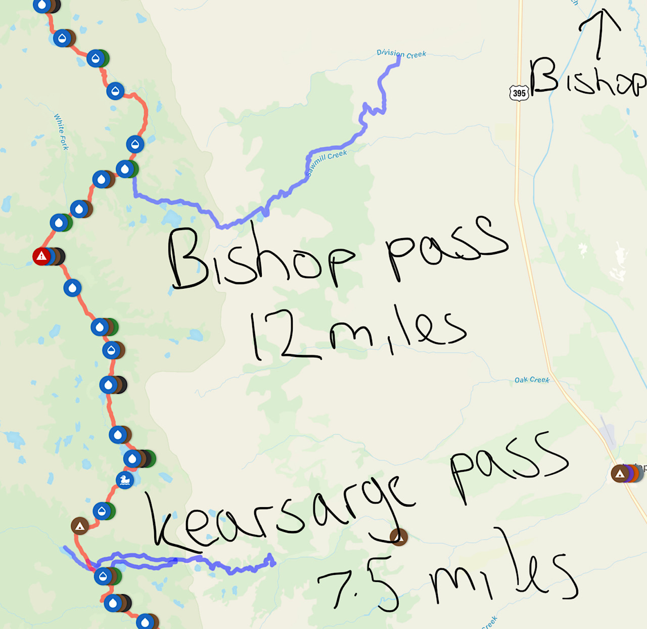
| 1846 | - | Independence or Bishop via Kearsarge Pass | See “Exit Points” section |
| 1907 | - | Lone Pine via Trail Pass | |
| 1950 | S. Kennedy Meadows | - | 1 mile road walk |
Exit Points
The Sierra is unique in that the trail does not cross many town-accessible roads, particularly between Red’s Meadow and South Kennedy Meadows. This means that any resupply must be done on-trail at one of the resorts (VVR or MTR), or by “exiting” using a trail that intersects the PCT.
The two commonly-used exit points are Kearsarge Pass (7.5 miles) and Bishop Pass (12 miles). Both are hard work - you can treat both of them as normal “pass” attempts in the Sierras, such as Muir or Forester Pass. They involve a steep climb up to a high peak (> 11,000 ft), then long descent to a trailhead.
These passes will drop you off at a trailhead parking lot. I didn’t hear of anyone having any issues getting a hitch, but be prepared to wait multiple hours or even overnight if you get there at a bad time.
Hitches to Bishop from Kearsarge trailhead might involve a transfer in Independence and a 40 minute ride.
And you have to get back and do it all again. All this makes the Bishop exit easily a 2-day affair.
The Resorts - convenient, but expensive
There are two mountain resorts located pretty much on-trail: Vermillion Valley Resort (VVR) and Muir Trail Ranch (MTR). Both are essentially mail-resupply only. They are very convenient! But you must prep these resupplies ahead of time if you want to use them.
Furthermore, they are expensive! For VVR, at the time of writing (2020 season) according to the website:
The fee for Packages scheduled for a May pick up is $50.00 or after September 15th - thru October Pick-Up is $50.00
You’ll be charged extra if the package weighs > 25 lbs. Furthermore:
VVR at Edison Lake is approximately two hours from the nearest U.S. Post Office or the U.P.S. drop point. Because of this we only pickup packages once or twice a week. Keep this in mind when planning your package arrival date. Please be sure that you send your package to arrive 10-14 days before YOU arrive!
MTR is even more expensive:
The service fee is US$85.00 for up to 25 pounds. (Buckets weighing over 25 pounds will be charged US$2.00 per pound overage fee.)
.. and must be mailed in a waterproof plastic bucket found at a hardware store.
Resort Closures
Both resorts will close their doors for resupply packages at some point during the SOBO season. Unfortunately, this is usually before every hiker has past through. Hikers who are moving slower than the main “bubble” risk not being able to pick up their resupply.
If you choose to use the resorts, keep checking the resort websites - they will tell you the closing date.
However, there’s no guarantee that this date will be honoured! The resorts may close several days before the date on the website.
- Estimate your arrival date for the resort you’re going to use. If you are within 4 days of when that resort is due to close, consider not using it.
- Get as much info as you can as you approach. Call the resort directly, on the phone. Speak to hikers going NOBO.
- If you are unsure as you approach, bring enough food to reach Bishop! Never risk running out of food in the Sierras!
Carry Capacity
Many people who use one of the resorts above will do so to avoid exiting the trail using one of the passes.
This will put you in for a long food carry!
| Muir Trail Ranch -> South Kennedy Meadows: 155 miles |
| Vermillion Valley Resort -> South Kennedy Meadows: 176 miles |
| Red’s Meadow Resort -> South Kennedy Meadows: 204 miles |
Certainly not impossible (I would guess that ~20% of people went for this option).
This section of trail is both very difficult on the body, and extremely beautiful, so you may not be doing 30 mile days.
Staying on vs Getting off
A single, clean push through the high Sierra without exiting is a wonderful experience. It saves you a lot of time and keeps you in the mountains. If you have your resupply sorted there are fewer things to worry about when you’re out there hiking.
For me personally, leaving the trail and taking a zero day in Bishop was exactly what my mind and body needed. This section is long, tiring, breathtaking, and the weather can be highly variable. I got out, enjoyed a hot shower and bed, purchased an extra layer of clothing, and relaxed. It’s a personal choice - do what is right for you.
Even if you planned to do a single push, always know you can bail if you need a break or the weather turns ugly.
Saving some time at North Kennedy Meadows
The default option seems to be to hitch into North Kennedy meadows, resupply, pick up a bear box, and enjoy their wood-burning stove!
UPDATE: It appears Sonora Pass Resupply company will be closed for 2020, and perhaps beyond.
The hitch can be a bit gnarly. A few hikers this year paid for Sonora Pass Resupply, a company that will deliver a full resupply (and bear box) direct to the trailhead. Plan it ahead of time and expect to pay an overhead.
Example Strategies
The Default
Pre-planning: none
Time: consuming
Cost overhead: none
| Location | On / Off Trail | Type | Miles to Next Resupply |
|---|---|---|---|
| North Kennedy | Hitch | Box | 109 |
| Mammoth Lakes | Hitch | Grocery Store | 118 + 7.5 side trail @ Kearsarge |
| Bishop | Hitch | Grocery Store | 86 |
Requires zero ahead-of-time planning, so very popular. Adds normally another 2-3 days onto your hike. No long carries. You get to experience the great towns of Mammoth Lakes and Bishop.
Variation: send a box to Red’s Meadow instead of hitching to Mammoth Lakes
The Single Push
Pre-planning: a lot
Time: speedy
Cost overhead: a lot
| Location | On / Off Trail | Type | Miles to Next Resupply |
|---|---|---|---|
| North Kennedy | Sonora Pass Resupply on-trail | Mail order items | 109 |
| Red’s Meadow | On-trail | Box | 50 |
| MTR | On-trail | Box | 155 |
Variation: send a box to Tuolumne Meadows instead of Red’s meadow. It spaces out the resupply stops better, however TM post office is closed for much of the weekend, and I know a bunch of people who got caught out by this! Also see 2022 update on the potential Tuolumne Meadows closure
The Roll-the-Dice
Pre-planning: not much
Time: Depends on if you pull it off
Cost overhead: none
It is common knowledge that MTR has amazing hiker boxes, full of food that JMT hikers have overpacked for their trip! I’ve heard of cornucopias of Mountain House meals ready to be packed out.
On the other hand, when I got there late September there was nothing!
So here’s the plan: pack enough food out of Red’s to make it to Bishop (which is your backup plan). If you get to MTR and can resupply out of the hiker boxes, do it and push through to South Kennedy Meadows. Otherwise you’ll have to exit to Bishop.
| Location | On / Off Trail | Type | Miles to Next Resupply |
|---|---|---|---|
| North Kennedy | Sonora Pass Resupply on-trail | Mail order items | 109 |
| Red’s Meadow | On-trail | Box | 50 or 118 if the trick doesn’t work!! |
| MTR | On-trail | Hiker boxes (!!!) | 155 |
This is a good strategy if you think you might want to make the single push, but don’t want to plan or pay for it. YMMV!
What to Expect
Keep these two pages bookmarked on your phone:
- PCTA Weather - direct links to NOAA weather forecasts at ~50 mile increments
- Inciweb Wildfire Updates - up-to-date reports of all active wildfires in the US
Washington
Daytime Temperatures: Warm
Nighttime Temperatures: Cold
Snow on ground: Yes! Micro spikes & Ice Axe might be required
Snow from sky: No
Rain: Very much yes!
Bugs: Yes, awful! Many mosquitos from Stevens Pass onwards
Elevation change: Very large
Water: Abundant
Difficulty: Hard
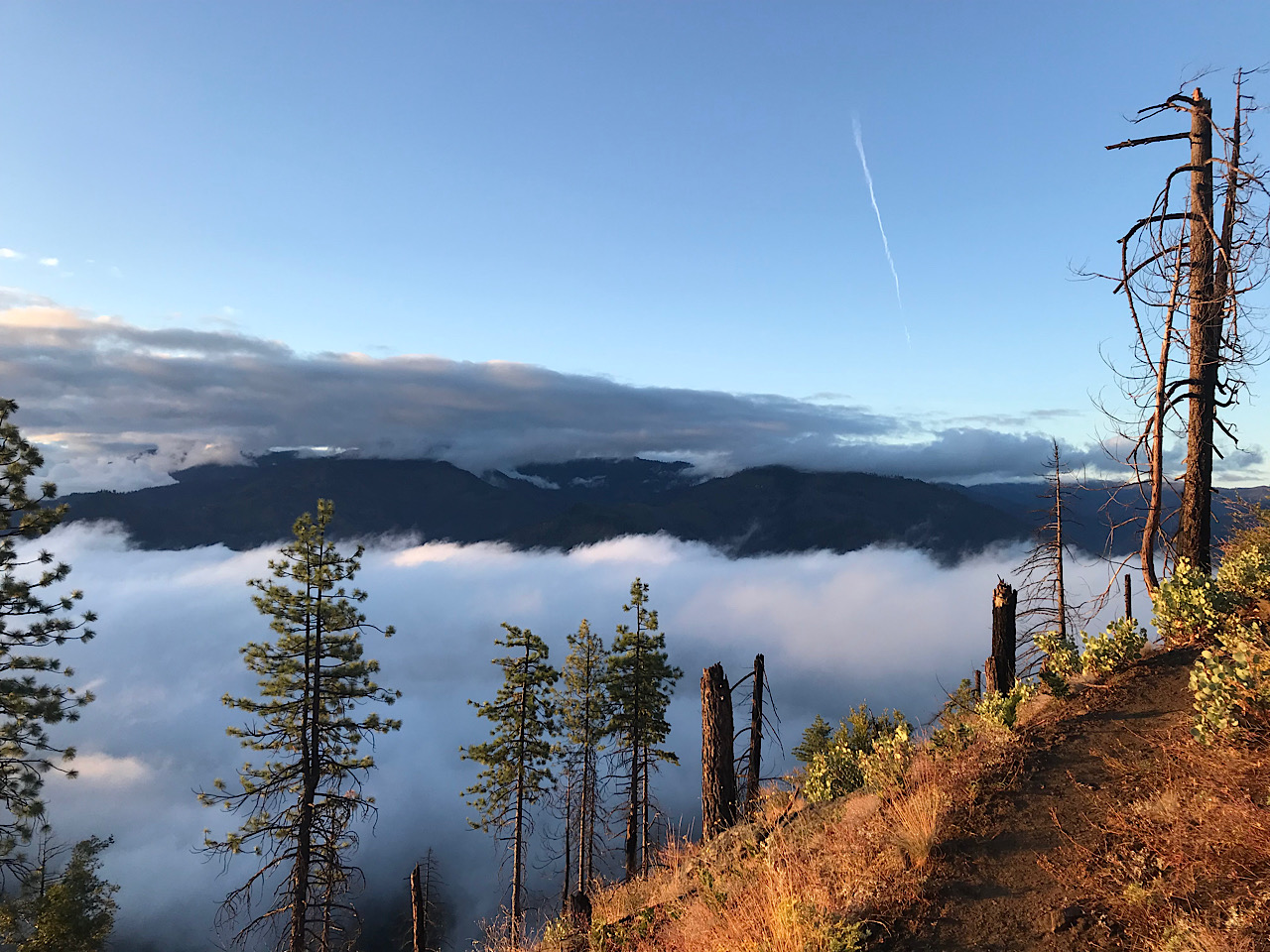
Washington is going to test you physically and mentally, not least due to the weather and conditions. This state will throw at you the largest variety of conditions you will probably experience on trail.
Elevation gain and loss is greater here than any other part trail. Blowdowns and bushes that haven’t been cut back yet will slow you down.
Washington is remote and it really feels that way. Long carries between towns are the norm (although, the addition of the Trout Lake shuttle service does provide relief). Cellphone service is almost non-existent in the Wildernesses.
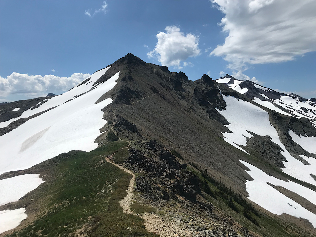
However, Washington blew me away with its beauty, ruggedness, magical pine forests, and alpine lakes. Over and again the North Cascades and Glacier peak top people’s lists of favourite section of the trail. Goat Rocks will take your breath away. The wildflowers of Mount Adams Wilderness particularly stick in my mind.
Snow
Most relevant is the snow on the ground. Depending on your start date, you might require micro spikes and even ice axe for the first 3 weeks of your trip.
The conventional wisdom is to choose a start date at least 7 days after the snow level at Harts Pass hits zero. Any sooner and snow traversal will slow you down if you don’t have adequate experience.
I found it hard to get good information about particular passes and sections - did we need the axe? Did we need the spikes?
- I would always recommend carrying spikes for the first 3 weeks.
- While at Harts Pass, ask people coming back from tagging the border about the snow conditions. You can leave unneeded equipment at the Harts Pass ranger station, and pick it up on your return.
- Check Guthook comments for Rock Pass (mile 13.6) Fire Creek Pass (mile 133.1)
Rain
Don’t be surprised if it rains every day from Harts Pass through to White Pass (the first 3 weeks). You might slog it 4,000 ft uphill, only to curse the persistent clouds and fog that can obscure any amazing views that would have made the payoff worthwhile. Stopping to dry out tents, clothing and sleeping bags will be an almost daily occurrence.
Bugs
Horrendous! Especially after the first week. Some of my lowest days on trail were due to bugs. You can barely take a 5 minute rest before you are consumed by a cloud of flying monsters. Get used to setting up your tent in record time, quickly leaping through the door, and spending the next 5 minutes squishing all the mosquitos that got inside.
- Bring a bug head-net
- Bring long wind or rain pants, or even bug-net pants
- Bring gloves
- Bring DEET
- Don’t let them get you down - they ease up in Oregon, and disappear in NorCal
Oregon
Daytime Temperatures: Hot
Nighttime Temperatures: Warm
Snow on ground: Almost none
Snow from sky: No
Rain: Little, but be prepared for a storm or two
Bugs: Quite bad at the start, easing off towards the end
Elevation change: Small - the flattest section of trail
Water: Mostly good, but a couple of 20-mile carries come to mind around Big Lake
Difficulty: Easy
Oregon is a welcomed respite after a difficult and draining Washington section. In some ways, it is nearly the polar opposite to Washington: very flat, towns / resorts every couple of days, and mild weather. Northern Oregon is incredibly scenic, particularly around Mount Jefferson and the Three Sisters Wilderness. You may be able to push some big-mile days here too, making up for a more cautious start through WA.
Swapping Gear
This might be the time to start considering switching out your cold-weather gear for lighter warm-weather options. Or at the very least mailing some unnecessary layers forward to Sierra City. The weather for the next 800 miles is going to be much warmer. Think about mailing out:
- Fleece or puffy (you only need one)
- Rain pants (unless this is your bug protection for your legs)
- Long sleeping underwear bottoms
- Long sleeve sleeping top (can be switched for t-shirt or something light)
- Gloves, woolly hat, balaclava
Additionally, maybe switching out:
- A heavy sleeping bag for something in the 30 - 40 degree F range
- A heavy pad for a short pad
You can potentially strip 2 - 4 lbs from your base weight if you’re ruthless about it.
Northern California
Daytime Temperatures: Very Hot
Nighttime Temperatures: Warm
Snow on ground: No
Snow from sky: No
Rain: Little
Bugs: No mosquitos. Occasional gnats (around Dunsmuir / Mount Shasta) can be annoying
Elevation change: Moderate to High
Water: Less good. More water carries, especially in the first 300 miles.
Difficulty: Hard
Northern California ratchets up the difficulty once again. Elevation change is fairly high, but the first thing to expect when crossing the state line into California is scorching heat and exposed sections of trail with little shade. Aside from the ever-present view of Mount Shasta (the mountain not the town), the scenery isn’t quite as good as you’ve had it so far. The descent into Seiad Valley, long road walk, and brutal climb is particularly testing.
After Belden however, the surroundings take on a decidedly more “Sierra” vibe. The weather cools and you’re treated to some great vistas as you approach Sierra City and Lake Tahoe.
This was where I personally felt at my physical peak - I was hitting 30+ mile days consistently while getting excited at the prospect of the approaching Sierra Nevada mountains.
NorCal-Sierra Boundary
Guthook tells us the Sierra starts at South Lake Tahoe. I would strongly consider treating Sierra City as the starting point. After this, the weather cools dramatically especially at night. I wished I had mailed my cold-weather clothes to Sierra City, when I was freezing my butt off at night in the Desolation Wilderness.
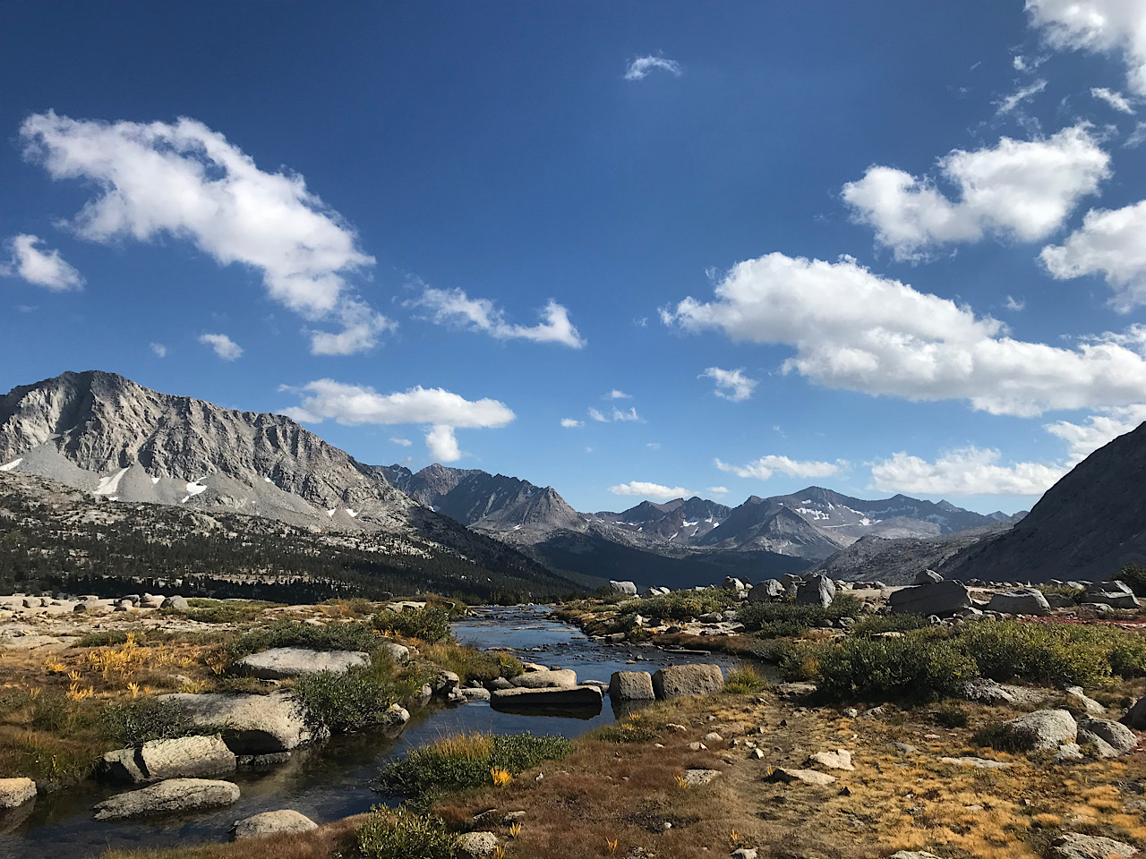
The Sierras
Daytime Temperatures: Warm
Nighttime Temperatures: Very Cold!
Snow on ground: No
Snow from sky: Yes
Rain: More likely to be snow than rain
Bugs: No
Elevation change: High
Water: Great - water everywhere
Difficulty: Hard
This is what you’ve been waiting for! The Sierras are like nothing else, so take it all in and enjoy. You’re gonna be working hard every day - big climbs over the various tall passes (Muir, Mather, Pinchot, Glen, and Forester) will really take it out of you, and put to the test all that preparation you’ve done over the last 2 months.
Cold
You’re gonna be grateful to have all your cold weather gear back, and might even want to consider packing out some extra just for this section. Temperatures at night can drop below 15F. If you don’t feel comfortable that your sleeping bag and pad are up to the challenge, you can make up for it with more clothes. Everyone I hiked with said they slept in every single layer for at least one of the nights.
Campsite selection is important. Choosing a site near the top of a pass might seem tempting but you’re likely in for a windy night. Similarly, cold air will settle at the very bottom of a valley or by a flowing stream. My coldest night was at Matterhorn Creek (mile 1,691) because of poor campsite selection - I didn’t sleep a wink :(
Blizzards
Snow in the Sierras can be dangerous, especially because of the lack of options to bail to a nearby town. Keeping up-to-date weather forecasts can be really helpful (accepting that mountain forecasting can be a real crapshoot). Muir Trail Ranch, Tuolumne Meadows and I believe Vermillion Valley Resort will keep forecasts updated for hikers. Many emergency satellite devices have a weather forecast function. Plan where you can bail if things turn sour, and don’t be afraid to take an earlier pass if you need it.
Altitude Effects
Being up between 10,000 and 13,000 ft has a significant effect on the body. Even if you don’t get sick, you’re likely to be slow and tired every day until you are fully acclimated. If you’re feeling exhausted and don’t know why, don’t be disheartened! Your strength should come back to you over time.
Don’t forget that you can lose all your gains if you spend extended time in low altitude trail towns! A good example: Bishop sits at 4,148 ft altitude. Within the next day or two you’ll be hitting 13,124 ft at Forester Pass.
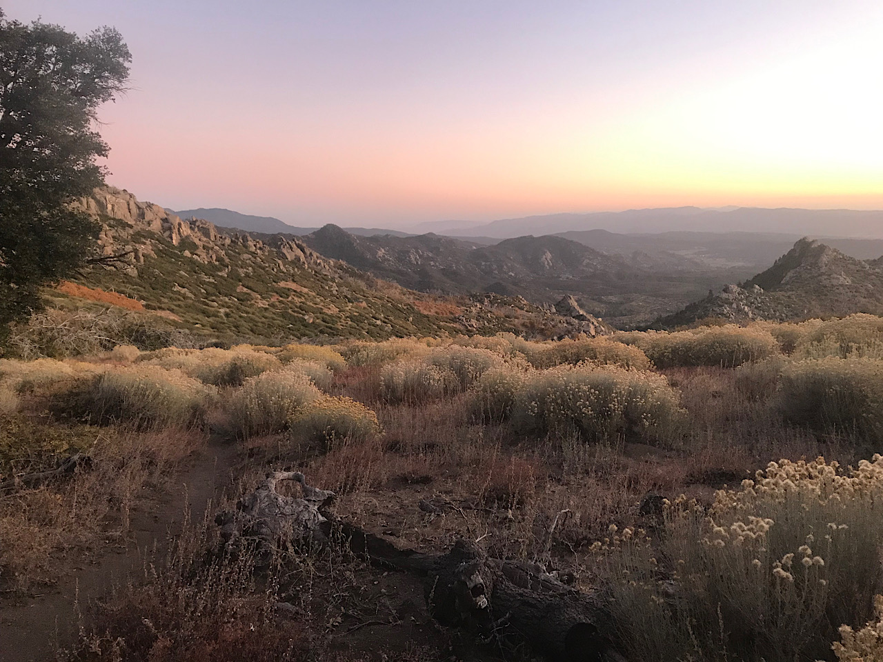
Southern California
Daytime Temperatures: Mostly warm, some hot days
Nighttime Temperatures: Cold
Snow on ground: No
Snow from sky: No
Rain: Unlikely
Bugs: No mosquitos, some gnats
Elevation change: Medium (San Jacinto is the exception)
Water: Bad - expect long carries between water caches
Difficulty: Medium
The desert of SoCal is the longest of the 5 sections, stretching from South Kennedy Meadows to the Mexican Border, a total of ~700 miles.
The days are much shorter now, so be prepared to do some night hiking (which might actually be beneficial to avoid the heat of the day). Water is extremely scarce, even for the NOBOs. You’ll likely be doing frequent 20+ mile water carries. Campsites near water sources will fill up with hikers all with the same plan, so expect to bunch up and lose some of that solitude you enjoyed at the start of your hike.
The desert can be grueling for many people. It was for me. My mind and body were exhausted, I missed the sweeping vistas and lush environment of the Sierras, and I was just ready to be done.
On the flip side, you’ll be treated to some wonderful trail towns. Idyllwild, Julian, Big Bear Lake, Wrightwood and Tehachapi were some of my favourites. Food carries are pretty light. Grocery stores are common and well stocked. Sunrise and sunset felt particularly magical in the desert.
And you’re almost done!
Cowboy Camping
If you haven’t been cowboy camping yet, this is prime territory. I didn’t sleep a single night under a shelter after reaching South Kennedy Meadows.
The chance of rain is going to be almost zero, but I wasn’t brave enough to send home my shelter.
Insects, spiders and snakes are definitely a thing in the desert. If you can overcome the fear, I would recommend cowboy camping to everyone as a beautiful experience.
Water
There’s not a lot of it! Received wisdom tells us not to rely on water caches, but anecdotally most people would do just that. There just isn’t much choice available to hikers. Keep checking Guthook as to the status of caches. Has there been a recent comment confirming plentiful water? I would always carry more water than I needed in event that a cache was unexpectedly dry.
I don’t think I ever carried more than 3 litres of water at any time. But I always kept 6 litres total carry capacity with a lightweight bladder just in case I needed it.
Shrink’s General Tips
These aren’t SOBO specific, but are just general things I picked up along the way.
Fixed Schedules
This is the cause of the so much stress on the trail:
- I’m meeting friend X on date Y at mile Z so we can hike together
- I need to be at town A by date B so I can go to a friend’s wedding in C
I can’t stress enough how much pressure this can put you under! It’s not easy to plan to be at an exact place on an exact date. You’ll be stressing about it weeks beforehand. You might need to leave your trail family if you have one. You might feel pressured to make up crazy miles before or after.
Resupply
Shipping - PO vs Private Business
In some towns you’ll have an option to ship to the Post Office, or ship to a private business (hotel, general store, trail angel etc.) for an additional fee.
In almost all cases, I prefer to ship to a private business, purely to avoid arriving at the PO on a day where it is closed.
POs are usually closed Sunday, and at least part of Saturday. Some of them close early on weekdays too.
Taking a forced zero day, or doing a big sprint to the PO just to make it there on a weekday is not fun! It happened many times to many of us on the trail.
If you have shipped to a PO start planning as far ahead as you can when you are going to arrive. If you know a week in advance that you’re gonna arrive on a weekend, you can start putting in extra miles gradually each day.
Online Shopping - Delivery to the Trail
It is hard to rely on good gear shops along the trail, except for large towns and the wonderful Triple Crown Outfitters in South Kennedy Meadows.
UPDATE: I’ve since learned that Amazon only occasionally uses USPS, and sometimes uses other carriers. This surprised me because I was sure I and many others used Amazon to send General Delivery. We might have just got lucky. So I can’t really recommend using Amazon at this time to send directly to Post Offices. Try instead to find a private business to send to who will accept multiple delivery methods.
If you don’t mind giving your money to billionaires, Amazon is very convenient. They ship USPS which means being able to send directly to the Post Office (with General Delivery).
The Amazon website often complains about General Delivery addresses, but they always worked fine for me. The best solution I found is:
1. Your Account
2. Your Addresses
3. Add New Address
4. (Type the address in)
5. Add Address
6. (Amazon might say it doesn’t recognise the address)
7. Click Add Address a second time
8. It works!
For other retailers - you’ll have to find out if they ship USPS or UPS. POs generally only accept UPS. Guthook will tell you which private businesses accept which delivery method.
Misc. Resupply Tips
- Go to Trout Lake! It’s a cute town, great milkshakes, and splits up the 150 miles between White Pass and Cascade Locks.
- Portland is great, but you’ll spend much of your day trying to get around the city. Consider Hood River instead. It’s a fun town and easy enough to navigate. You can get there by bus from Cascade Locks.
- For shipping out boxes, private all-in-one stores like Postal Annex are super convenient: you can ship USPS, UPS and FEDEX from one place.
- Download all the apps (USPS, UPS, FEDEX) and always enter tracking numbers when you get them.
- Never put Tide Pods in your resupply boxes! They will make everything in your box taste of laundry detergent.
- For your boxes in WA, less is more! You won’t have hiker hunger yet. You can usually supplement with more food if you need it from stores. Hiker Boxes are notoriously full in WA.
- Make your WA boxes before you go. The rest can be made up while you’re on trail, from bigger towns (Hood River, Ashland, Mt Shasta, Tehachapi). Your OR and CA boxes will be far nicer and more attuned to your needs.
Hitchhiking
Most people starting the trail have had little to no experience hitchhiking. It doesn’t stay that way for long!
On the PCT, hitchhiking is a requirement. But don’t fear! It seems scary, but you’ll get the confidence you need quickly, and soon you’ll be a well-oiled hitching machine!
When I started out I was pretty nervous about the whole thing. Looking back, I realise that hitching might be one of my favourite experiences on trail. You meet wonderful people, get great stories, and witness the kindness of strangers first-hand.
These tips are pretty generic, but I hope they are helpful:
- The optimal number of hitchers to a ride is probably 2 or 3. You’ll feel safer as a group, but too large a group and you might put off a passing driver.
- Women seem to have a better chance of getting a hitch than men, so it makes sense for them to be in front when on the side of the road.
- Look presentable! Make sure you’ve brushed your teeth that morning.
- Packs out in front of you at your feet. This shows you are a hiker. Hikers get hitches quicker than hobos do.
- Hitches into and out of trail towns are usually easy - the locals know what you’re doing and likely want to help you. If you’re trying to get somewhere further away from trail, you might have a harder time of it.
- Location is key. Make sure the driver has somewhere safe to pull over behind you. Make sure you’re visible when they are coming towards you - blind corners aren’t good hitching places.
- Smile! :)
Other Resources
Here are some other resources I would recommend checking out:
I’ve tried to keep it mostly about things that are unique to going SOBO (except the Shrink’s General Tips section). I would recommend reading this guide in addition to a more general-purpose resource out there:
Also, please do check out these other really excellent SOBO resources: